


GPS, Maps, Driving Directions
4.04.95K Reviews
App Specs
- Version
- 14.17
- Updated On
- License
- Free
- Downloads
- 100,000,000+
- Developer
- AppVerge Technologies, LLC
- Categories
- Maps & Navigation
- Platform
- Android
Screenshots
 Analysis by AppCompare
I judge a navigation app not only by whether it can find a destination, but by how easy it is to understand when plans change or the road gets busy. GPS, Maps, Driving Directions is a free maps and navigation app from AppVerge Technologies, LLC, and its mix of driving guidance, traffic information, and offline maps gives it a practical role in everyday trips. Its 4.0 average from around 107,000 ratings suggests a broad audience, though no navigation tool is equally comfortable for every driver or every situation.
Readability and making sense of a route
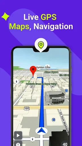
A map is useful only if I can take in the information quickly. The original appeal here is a straightforward interface, with map views such as satellite and terrain to help make the surroundings easier to interpret. Satellite imagery can be handy when a building entrance or the shape of a property matters more than street names; terrain is more relevant when the landscape itself affects a journey. Switching perspectives is useful, but it is still worth choosing a view before setting off rather than experimenting while driving.
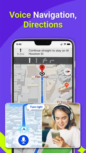
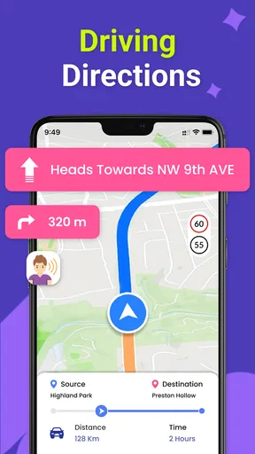
Turn-by-turn guidance and spoken directions offer two ways to follow a route. I would use the voice prompts as the main cue on an unfamiliar road and glance at the map only when safely stopped or when a passenger can check it. Spoken guidance reduces the need to keep reading the screen, but it does not remove the need to pay attention: a prompt can arrive at a complicated junction where road signs and lane markings still matter. If a direction feels unclear, I would follow the actual road layout rather than make a sudden maneuver to satisfy the screen.
Guides and Analysis on GPS, Maps, Driving Directions
The app is listed as suitable for everyone, and its broad appeal is easy to understand: drivers, passengers, and people exploring a new area can all get value from a map and route guidance. That age designation is not a promise that every part of the interface will suit every person. Anyone who has difficulty reading small labels, distinguishing map details, or processing spoken prompts should check how it feels on their own device before relying on it for a demanding trip.
Getting Started with GPS, Maps, Driving Directions
Diving into the app is pretty straightforward. Once you download it, you’re greeted with a clean and intuitive interface. Setting up is a breeze – just a few taps and you're good to go. The app offers a variety of map views, from satellite to terrain, making it super flexible depending on your needs.
One thing I noticed right away is how fast the app loads. No more staring at the spinning wheel of doom while waiting for maps to load. Whether you’re on Wi-Fi or mobile data, the app performs like a champ.
Motor and sensory considerations on the move
Navigation can demand attention at exactly the moment a driver has the least spare capacity. I find it useful to enter the destination, review the route, and set up the sound before moving, then keep interaction to a minimum on the road. That workflow can also help someone who has limited dexterity, hand pain, or difficulty making quick touchscreen selections. It is not a substitute for a passenger or a safe place to stop when the route needs changing.
Worth Reading Before You Choose

Basketball Stars: Multiplayer Is Fast, but Can It Recover When Matches Go Wrong?

WEBTOON Turns Phone Updates Into a Better Reading Routine

Link to Windows Runs on Shared Habits, Not Social Feeds

How Alibaba.com Dominates the B2B Marketplace

Metro's Quiet Rise: Redefining Mobile Communication

Harnessing Ecosystem Power with Phone Tracker by Number
Voice prompts can be helpful for people who would rather listen than repeatedly look down, while the map provides a visual backup when a spoken instruction needs context. The trade-off is that audio may be hard to hear in a noisy vehicle, distracting in a quiet one, or difficult to follow for someone with hearing loss or auditory-processing needs. I would test the guidance at a comfortable volume before depending on it, and avoid trying to compensate by staring at the screen.
People who are sensitive to visual clutter may prefer to settle on the map view they find easiest to read before starting. Satellite imagery can provide recognizable visual landmarks, but it may also be busier than a simpler road-focused display. Terrain offers a different kind of context rather than a universal improvement. The useful choice is the one that makes the next decision clearer, not the one with the most detail.
Features That Stand Out
Let’s talk about the features. The GPS, Maps, Driving Directions app goes beyond just showing you a map. It offers turn-by-turn navigation, which is perfect for those of us who need a little extra guidance on the road. The voice navigation is clear and concise, ensuring you never miss a turn.
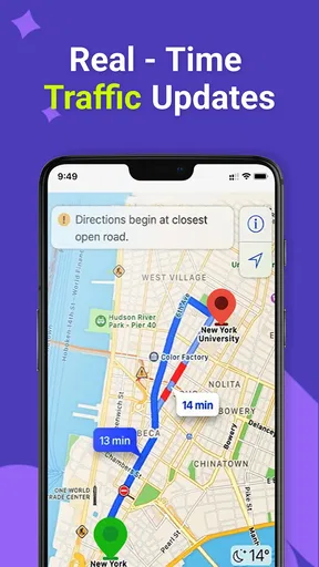
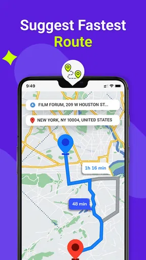
Another cool feature is the live traffic updates. This has become my go-to when trying to avoid the dreaded rush hour. The app provides real-time traffic conditions, suggesting alternative routes when things start to get congested. It's like having a traffic helicopter in your pocket!
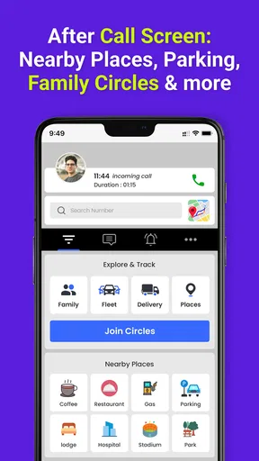
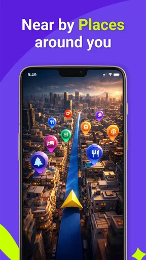
For the explorers, the app includes a discovery feature that highlights points of interest nearby. Whether it's a hidden café or a scenic park, you'll never run out of places to discover.
Everyday routes, offline preparation, and alternatives
A realistic weekday use is a commute that starts normally but runs into congestion on the way to an appointment. Traffic updates and a suggested alternative can help me decide whether a different route is worth taking, but I would compare the proposed change with the remaining distance and the roads I know. A detour is not automatically faster or easier: if I am close to the destination, unfamiliar turns may add stress without saving meaningful time.
Offline maps are particularly useful when a trip includes a rural stretch, a basement parking area, or a destination where mobile reception may be unreliable. The practical tip is to prepare before leaving: make sure the relevant map area is available offline and check the route while connected. Offline access can help with map availability, but I would not assume it supplies live traffic updates when there is no connection. For a trip where current road conditions are essential, I would check them before entering a coverage gap.
The nearby discovery feature suits a different task from turn-by-turn driving: finding a place to pause, eat, or explore once parked. I would use it as a starting point, then check that a point of interest fits the actual plan rather than treating every nearby result as a recommendation. This makes the feature more useful for flexible outings than for time-critical errands where I already know the address.
Compared with relying on a phone’s built-in map app, this one brings route guidance, traffic, offline maps, and nearby discovery into a dedicated navigation experience. If you already like your default map app and it meets your needs, switching may not add enough to justify changing habits. A paper map remains a sensible backup for broad orientation or device failure, but it cannot react to current congestion. For people who travel in areas with weak reception, offline preparation matters more than any comparison of interface preferences.
Situational access and remaining barriers
This app is most appealing to drivers who want spoken route prompts and the option to prepare for patchy coverage, as well as travelers who appreciate nearby places to explore. It can also be useful for a passenger helping with navigation. It is less suitable for someone who needs a guaranteed specialized accessibility interface, a hands-free setup they have not tested, or navigation that can be operated comfortably without visual or spoken information. In those cases, I would try the app in a low-pressure setting first and keep another navigation method available.
There are practical questions worth answering before a longer drive. The app is free to download, with optional in-app purchases priced from $2.49 to $19.99 per item, so I would check the purchase details in the app rather than assume a particular feature requires payment. It has more than 50 million installs, and version 13.81 supports Android 7.0 and later. Those figures describe its reach and compatibility, but they do not guarantee that it will feel equally smooth on every phone.
Another limitation is the attention navigation can consume even when its instructions are simple. A screen that is easy to understand while parked may be harder to process at night, in heavy traffic, or when a route changes at a complex intersection. I recommend setting the destination before driving, keeping the phone secured in a safe position, and pulling over before making a complicated change. Anyone who finds the map difficult to read should try a short, familiar journey first rather than discovering that problem on an unfamiliar route.
AppVerge Technologies, LLC has built a general-purpose option rather than a tool I would describe as tailored to one particular access need. That distinction matters: voice directions and offline maps can reduce some barriers, but they do not address every visual, motor, hearing, or cognitive requirement. If navigation is part of a daily accessibility plan, test the exact combination of phone, sound, map view, and mounting position you intend to use. A companion, familiar route, or alternative navigation aid may still be the better choice in difficult conditions.
Why You’ll Love It
What really sets this app apart is its accuracy and reliability. I’ve used it in various cities, from bustling urban centers to quiet rural areas, and it hasn't let me down. The app also supports offline maps, which is a lifesaver when you’re in areas with spotty reception.
Another aspect worth mentioning is the user-friendly interface. Everything is where you expect it to be, so you’re not fumbling around while driving. Safety first, folks!
An inclusive verdict for everyday navigation
For me, the strongest case for this app is its combination of useful route guidance and preparation options, especially for people who drive regularly and sometimes travel beyond reliable mobile coverage. The traffic information can help with changing conditions, while nearby discovery gives casual outings another practical use. Its 4.0 average reflects a well-used product, but I would treat ratings as a broad impression, not proof that it will work perfectly for my routes or access needs.
I would recommend trying it on a familiar trip, checking whether the map is comfortable to read, and listening to the prompts before depending on them in a busy setting. If it fits your habits, it can be a capable everyday companion. If you need specialist accessibility controls, prefer a different mapping style, or already have a built-in navigation app that works better for you, there is no reason to switch just for the sake of switching.
Final Thoughts
All in all, the GPS, Maps, Driving Directions app is a must-have for anyone who spends a lot of time on the road. Its combination of ease of use, robust features, and reliable performance makes it a standout in the crowded field of navigation apps.
Whether you’re a daily commuter or an occasional traveler, this app is bound to make your journeys smoother and more enjoyable. So, next time you’re planning a trip, make sure you have this trusty navigator by your side. Safe travels!
Pros
- User-friendly interface for easy navigation.
- Accurate real-time traffic updates.
- Offline maps reduce data usage.
- Customizable route options available.
- Voice-guided navigation enhances safety.
Cons
- Battery consumption can be high.
- Occasional map loading delays.
- Limited features in free version.
- Frequent ads disrupt user experience.
- Requires constant GPS signal for accuracy.
FAQs for GPS, Maps, Driving Directions
Is the GPS, Maps, Driving Directions app available for free?
Yes, the GPS, Maps, Driving Directions app is available for free on both Android and iOS platforms. While the basic features are accessible without any charges, there might be optional in-app purchases or premium features that require a subscription to enhance the overall user experience.
Does the app work offline, or do I need an internet connection?
The app offers offline capabilities, allowing users to download maps for regions they plan to visit. This feature ensures you can access maps and directions without an active internet connection, which is particularly useful when traveling to areas with limited network coverage. However, some features like real-time traffic updates require an internet connection.
How accurate is the navigation and traffic information provided by the app?
The app is designed to provide highly accurate navigation and real-time traffic information by utilizing GPS technology and data from various sources. While it generally offers reliable directions and updates, occasional discrepancies can occur due to sudden traffic changes or construction work. Regular updates help maintain accuracy.
Can I customize my route preferences within the app?
Yes, the app allows users to customize their route preferences to suit individual needs. You can select options such as avoiding toll roads, highways, or ferries. Additionally, users can set preferences for walking, cycling, or driving modes, ensuring the app provides the most suitable directions for your journey.
Is my location and data secure when using the app?
The app prioritizes user privacy and data security, employing encryption and other protective measures to safeguard your personal information. While using location services, your data is generally anonymized. It's always recommended to review the app’s privacy policy and settings to understand how your information is managed.


